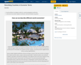
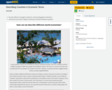
Describe different sociological models for understanding global stratificationUnderstand how studies of global …
Describe different sociological models for understanding global stratificationUnderstand how studies of global stratification identify worldwide inequalities
Describe different sociological models for understanding global stratification Understand how studies of global …
Describe different sociological models for understanding global stratification Understand how studies of global stratification identify worldwide inequalities
Geographic information systems (GIS), once used predominantly by experts in cartography and …
Geographic information systems (GIS), once used predominantly by experts in cartography and computer programming, have become pervasive in everyday business and consumer use. This unit explores GIS in general as a technology about which much more can be learned, and it also explores applications of that technology. Students experience GIS technology through the use of Google Earth on the environmental topic of plastics in the ocean in an area known as the Great Pacific Garbage Patch. The use of this topic in GIS makes the unit multidisciplinary, incorporating the physics of ocean currents, the chemistry associated with pollutant degradation and chemical sorption to organic-rich plastics, and ecological impact to aquatic biota.
What factors lead to a natural disaster? What causes a famine? Why …
What factors lead to a natural disaster? What causes a famine? Why do cities flood? According to a recent article in The Atlantic, Houston's flooding during the 2017 Hurricane Harvey was primarily caused by impervious pavement which prevents the absorption of water into the land. This example illustrates how nature and society are interlinked, which is the main focus of Geography 30, Penn State's introductory course to nature-society geography. In addition to examining the linkages between human development and natural hazards, this course will also explore human society's connection to food systems, climate change, urbanization and biodiversity. The course will also cover topics of ethics and decision making in order to help students evaluate the tradeoffs of these interconnections. \The Atlantic\" needs to be made into a link pointing to this: https://www.theatlantic.com/technology/archive/2017/08/why-cities-flood/538251/"
Geographic Intelligence (GEOINT) is more than people working with computers in a …
Geographic Intelligence (GEOINT) is more than people working with computers in a secure intelligence facility. Join us for this exciting journey to learn about GEOINT's application in business, law enforcement, and defense. Advances in satellites, GPS, unmanned aerial systems, wireless communications, handheld computing, and the ability to automate laborious map analysis processes has transformed what used to be called geographic intelligence, or GEOINT, and the nature of the insights provided to managers and leaders. We have gone from mountains of hardcopy maps to amazing automated systems that provide previously unavailable understanding. GEOINT combines geographic information science and technologies with an analytic tradecraft. You will experience the value of GEOINT. We welcome you to the Revolution.
History For All the People is the State Archives of North Carolina …
History For All the People is the State Archives of North Carolina blog – a space for discussing new projects, upcoming events and other (hopefully) interesting news from 109 E. Jones St. in Raleigh, N.C.
Human geography emphasizes the importance of geography as a field of inquiry …
Human geography emphasizes the importance of geography as a field of inquiry and introduces students to the concept of spatial organization. Knowing the location of places, people, and events is a gateway to understanding complex environmental relationships and interconnections among places and across landscapes.
Geographic concepts emphasize location, space, place, scale of analysis, pattern, regionalization, and globalization. These concepts are essential to understanding spatial interaction and spatial behavior, the dynamics of human population growth and migration, patterns of culture, political control of territory, areas of agricultural production, the changing location of industry and economic development strategies, and evolving human settlement patterns, particularly urbanization. Geographers use geospatial technology (e.g., satellite imagery, aerial photography, geographic information systems (GIS), global positioning systems (GPS), and drone technology), spatial data, mathematical formulas, and design models to understand the world from a spatial perspective better.
Human geography enables us to consider the regional organization of various phenomena and encourages geographic analysis to understand processes in a changing world. For example, geographic perspectives on the impact of human activities on the environment, from local to global scales, include effects on land, water, atmosphere, population, biodiversity, and climate. These human ecological examples are inherent throughout the discipline, especially in topics dealing with population growth, agricultural and industrial practices, and rapid urbanization. Geographers apply geographic methods and geospatial technologies to a variety of situations.
The past decade has seen an explosion of new mechanisms for understanding …
The past decade has seen an explosion of new mechanisms for understanding and using location information in widely-accessible technologies. This Geospatial Revolution has resulted in the development of consumer GPS tools, interactive web maps, and location-aware mobile devices. This course brings together core concepts in cartography, geographic information systems, and spatial thinking with real-world examples to provide the fundamentals necessary to engage with Geographic Information Science. We explore what makes spatial information special, how spatial data is created, how spatial analysis is conducted, and how to design maps so that they're effective at telling the stories we wish to share. To gain experience using this knowledge, we work with the latest mapping and analysis software to explore geographic problems.
Physical Geography, also called earth science, is the study of our home …
Physical Geography, also called earth science, is the study of our home planet and all of its components: its lands, waters, atmosphere, and interior. In this book, some chapters are devoted to the processes that shape the lands and impact people. Other chapters depict the processes of the atmosphere and its relationship to the planets surface and all our living creatures. For as long as people have been on the planet, humans have had to live within Earths boundaries. Now human life is having a profound effect on the planet. Several chapters are devoted to the effect people have on the planet.The journey to better understanding Earth begins here with an exploration of how scientists learn about the natural world and introduces you to the study of physical geography and earth science.
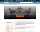
The Civil War, from 1861 to 1865, is the centerpiece of our …
The Civil War, from 1861 to 1865, is the centerpiece of our nation's story. It looms large, not merely because of its brutality and scope but because of its place in the course of American history. The seeds of war were planted long before 1861 and the conflict remains part of our national memory. Geography has helped shape this narrative. The physical landscape influenced economic differences between the regions, the desire to expand into new territories, the execution of the conflict both in the field and on the home front, and the ways in which our recollections have been shaped. Maps enable us to present the complex strands that, when woven together, provide a detailed account of the causes and conduct of the war. These visual images remain a salient aspect of our memory. Photographs, prints, diaries, songs and letters enhance our ability to tell this story, when our nation, as a Currier & Ives cartoon depicts, was about to be "Torn in Two." This exhibition tells the story of the American Civil War both nationally and locally in Boston, Massachusetts, through maps, documents, letters, and other primary sources. This exhibition was developed by the Norman B. Leventhal Map Center, a nonprofit organization established as a partnership between the Boston Public Library and philanthropist Norman Leventhal.
Students complete a self-guided exercise in worksheet format combined with Google Earth …
Students complete a self-guided exercise in worksheet format combined with Google Earth that helps them explore practical and observable differences between different projection and coordinate systems. The activity improves their skills in using various Google Earth features.
Students learn about coordinate systems in general by considering questions concerning what …
Students learn about coordinate systems in general by considering questions concerning what it is that the systems are expected do, and who decided how they look. They attempt to make their own coordinate systems using a common area across all groups and compete to see who can make the best one. Then they analyze why it is that some systems work better than others and consider what those observations mean for evaluating and choosing geographic coordinate systems commonly available today.
The discipline of geography bridges the social sciences with the physical sciences …
The discipline of geography bridges the social sciences with the physical sciences and can provide a framework for understanding our world. By studying geography, we can begin to understand the relationships and common factors that tie our human community together. The world is undergoing globalization on a massive scale as a result of the rapid transfer of information and technology and the growth of modes of transportation and communication. The more we understand our world, the better prepared we will be to address the issues that confront our future. There are many approaches to studying world geography. This textbook takes a regional approach and focuses on themes that illustrate the globalization process, which in turn assists us in better understanding our global community and its current affairs.
No restrictions on your remixing, redistributing, or making derivative works. Give credit to the author, as required.
Your remixing, redistributing, or making derivatives works comes with some restrictions, including how it is shared.
Your redistributing comes with some restrictions. Do not remix or make derivative works.
Most restrictive license type. Prohibits most uses, sharing, and any changes.
Copyrighted materials, available under Fair Use and the TEACH Act for US-based educators, or other custom arrangements. Go to the resource provider to see their individual restrictions.