Renters play an important role as policy actors in urban structure. This …
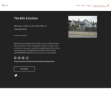
Renters play an important role as policy actors in urban structure. This text calls for a closer examination of renters as policy actors in Kitsilano, Vancouver, a gentrified neighbourhood with a critical housing shortage. AFFORDABLE-HOUSING INITIATIVES AND RENTERS’ RIGHTS artwork courtesy of Graham White.
An interactive map based on four decades of satellite images helps residents, …
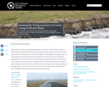
An interactive map based on four decades of satellite images helps residents, resource managers, and stewards of the land anticipate and plan for coastal change.
We developed this Natural Hazards book to fill the void we found …
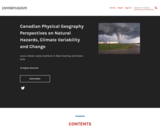
We developed this Natural Hazards book to fill the void we found and contribute a Canadian version to the public. We both feel that Open Education Resources (OER) are an excellent way to share the body of knowledge and work of those in the Physical Geography discipline. Each chapter in this book started with a chapter drawn from another OER and then edited to our own material we have used while teaching our classes in Natural Hazards for over 15 years. We will use the feedback from our students in 2021 and 2022 classes to finalize this book too.
Maps capture the power of place. A well-designed map can stoke our …
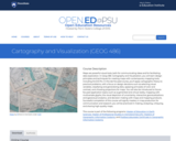
Maps capture the power of place. A well-designed map can stoke our imagination, helping us to understand how a place looks or feels. Maps serve two roles. First, maps facilitate visual communication where knowns are presented to map readers. Second, maps permit visual thinking where insights into patterns and trends in spatial data are explored. In GEOG 486, Cartography & Visualization, you will learn and apply cartographic theory creating appropriately designed maps. You will learn how to associate the visual variables to symbolize types of spatial data. This process creates an appropriate visual hierarchy that conveys an informational hierarchy about the underlying message. Thus, techniques in map design will be applied to produce, evaluate, and critique reference and thematic maps.
This text, The Cause and Consequence of Human Trafficking: Human Rights Violations, …
This text, The Cause and Consequence of Human Trafficking: Human Rights Violations, is intended to convey the importance of understanding how the violation of human rights is a cause and consequence of human trafficking.
The origin of this book is in conversations I had over the …
The origin of this book is in conversations I had over the years with several colleagues in the field of Sinology (the study of history, literature and culture of traditional China). The course title did not only attract the attention of the students, but also of people who would like to teach this material, and asked me for the syllabus and even suggested I write a textbook. What meets the eye at first is a set of chapters written by the students who took the course in Spring 2019. The students are not experts at China, they do not know Chinese and thus had to rely on English-language materials available to them through our library and my personal collection. Many are at the start of their journey of learning to write for their college-level peers.
Ce livre propose les portraits de 31 femmes de différents pays et …
Ce livre propose les portraits de 31 femmes de différents pays et de différentes époques qui ont un point commun : elles se sont engagées à un moment de leur vie pour transformer la société dans laquelle elles vivaient, dans l’espoir de la rendre plus vivable, plus juste, plus équitable, plus libre.
Comment s’engager dans des actions en faveur de la vie et du …
Comment s’engager dans des actions en faveur de la vie et du bien commun en cette période marquée par des problèmes d’envergure planétaire tels que le réchauffement climatique, la pollution accrue, l’acidification des océans ou les menaces sur la biodiversité? Des gouvernements tentent tant bien que mal de s’entendre pour agir.
Is your understanding of Cloud GIS a bit hazy? Does thinking about …
Is your understanding of Cloud GIS a bit hazy? Does thinking about it leave you in a fog? We've designed GEOG 865, Cloud and Server GIS, to help you understand how all of the various pieces of architecture fit together. By the end of the class you'll have a clear understanding of esri's and others' offerings in the space, how to implement ArcGIS Enterprise on Amazon EC2, make online maps with Carto and Mapbox, and engage in some blue sky thinking of your own in our weekly discussions about trends and directions.
The contents of this online book were created by Prof. Rick Bonus …
The contents of this online book were created by Prof. Rick Bonus and his students as a final project for a course on “Critical Filipinx American Histories” in the Fall quarter of 2019 at the University of Washington, Seattle campus. In collaboration with the UW Libraries, the UW Burke Museum, and the UW Department of American Ethnic Studies, this book explores and reflects on the relationships between Filipinx American histories and selected artifacts at the Burke Museum. It is a class project that was made possible by the Allen Open Textbook Grant.
GEOG 571 explores the relationships between culture and civil security and the …
GEOG 571 explores the relationships between culture and civil security and the process of geographically analyzing social, political, economic, and demographic information to understand human history, institutions, and behaviors. It is an elective course in the Geospatial Intelligence Certificate, the Intercollege Master of Professional Studies (iMPS-HLS), and the Master of Geographic Information Systems degree program that is offered exclusively through Penn State's World Campus. It is also one of the optional capstone courses that leads to Penn State's Postbaccalaureate Certificate in GIS. The course consists of projects, associated readings, and exams.
Ce dictionnaire a été d’abord pensé pour répondre aux besoins de formation …
Ce dictionnaire a été d’abord pensé pour répondre aux besoins de formation des équipes internationales du projet Yanayi[1], qui vise la co-création d’une base internationale de données ouvertes qualitatives sur les changements climatiques tels que vécus, observés, analysés et combattus par des aînés et des aînées d’Afrique francophone subsaharienne et d’Haïti et racontés à des étudiants et étudiantes affilié-e-s à 10 boutiques des sciences et des savoirs.Cet ambitieux et énorme projet ne pourra avancer que s’il repose sur la collaboration de nombreux participants et nombreuses participantes.Il est possible de : se proposer pour rédiger une entrée qui est encore disponible, c’est-à-dire qui apparaît dans la table des matières du Dictionnaire; proposer une entrée qui est absente du dictionnaire, avec ou sans texte; proposer ses services pour traduire des entrées dans des langues africaines; réviser et compléter une entrée; réviser les références bibliographiques et la qualité linguistique des entrées. L’adresse mail de contact est reseauliraj@gmail.com. Merci d’y envoyer toutes vos questions ou propositions.
Geographic information systems (GIS), once used predominantly by experts in cartography and …
Geographic information systems (GIS), once used predominantly by experts in cartography and computer programming, have become pervasive in everyday business and consumer use. This unit explores GIS in general as a technology about which much more can be learned, and it also explores applications of that technology. Students experience GIS technology through the use of Google Earth on the environmental topic of plastics in the ocean in an area known as the Great Pacific Garbage Patch. The use of this topic in GIS makes the unit multidisciplinary, incorporating the physics of ocean currents, the chemistry associated with pollutant degradation and chemical sorption to organic-rich plastics, and ecological impact to aquatic biota.
Is Energy and GIS your passion? If so, Energy Industry Applications of …
Is Energy and GIS your passion? If so, Energy Industry Applications of GIS provides students with an in-depth exploration of the complexities of siting decisions in the electricity market. The course introduces a variety of siting challenges that confront the energy industry and its customers and neighbors but focuses on the siting of electrical transmission lines. The course also provides hands-on experience with a common decision support technology, ArcGIS, and considers how the technology may be used to facilitate public participation in siting decisions.
Increasingly volatile climate and weather; vulnerable drinking water supplies; shrinking wildlife habitats; …
Increasingly volatile climate and weather; vulnerable drinking water supplies; shrinking wildlife habitats; widespread deforestation due to energy and food production. These are examples of environmental challenges that are of critical importance in our world, both in far away places and close to home, and are particularly well suited to inquiry using geographic information systems. In GEOG 487 you will explore topics like these and learn about data and spatial analysis techniques commonly employed in environmental applications. After taking this course you will be equipped with relevant analytical approaches and tools that you can readily apply to your own environmental contexts.
ìExploring Imagery and Elevation Data in GIS Applicationsî (GEOG 480) focuses on …
ìExploring Imagery and Elevation Data in GIS Applicationsî (GEOG 480) focuses on the use of remotely sensed imagery and elevation data in GIS applications. Students enrolling in GEOG 480 should have a solid conceptual foundation in geospatial information science and technology. GEOG 480 is appropriate for those who are already working in the geospatial profession and wish to use imagery and elevation data in visualization and spatial analysis. Throughout the course, students confront realistic remote sensing problem scenarios that incorporate such skills and concepts as definition of data needs, metadata content standards, data formats and types, and analysis methods.
In GEOG 489, you will learn advanced applications of Python for developing …
In GEOG 489, you will learn advanced applications of Python for developing and customizing GIS software, designing user interfaces, solving complex geoprocessing tasks, and leveraging open source. The course consists of readings, walkthroughs, projects, quizzes, and discussions about advanced GIS programming concepts and techniques, and a final term project. It complements the material covered in GEOG 485: GIS Programming and Customization. Software covered in the course includes: Esri ArcGIS Pro/arcpy, Jupyter Notebook, Esri ArcGIS API for Python, QGIS, GDAL/OGR. Students will also use of the Git version control software for code management, and learn techniques for distributing Python applications to end users.
The resource "AP Exam Prep" is a module in the "AP Human …
The resource "AP Exam Prep" is a module in the "AP Human Geography" course. The course is included in the Georgia Virtual Learning resource series available in the open educational resources collection of the NCLOR. This resource is included in the Arts and Humanities discipline with the subject of Geography and travel.
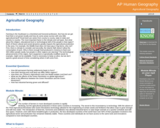
The resource "Agricultural Geography" is a module in the "AP Human Geography" …
The resource "Agricultural Geography" is a module in the "AP Human Geography" course. The course is included in the Georgia Virtual Learning resource series available in the open educational resources collection of the NCLOR. This resource is included in the Arts and Humanities discipline with the subject of Geography and travel.
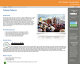
The resource "Cultural Patterns" is a module in the "AP Human Geography" …
The resource "Cultural Patterns" is a module in the "AP Human Geography" course. The course is included in the Georgia Virtual Learning resource series available in the open educational resources collection of the NCLOR. This resource is included in the Arts and Humanities discipline with the subject of Geography and travel.
No restrictions on your remixing, redistributing, or making derivative works. Give credit to the author, as required.
Your remixing, redistributing, or making derivatives works comes with some restrictions, including how it is shared.
Your redistributing comes with some restrictions. Do not remix or make derivative works.
Most restrictive license type. Prohibits most uses, sharing, and any changes.
Copyrighted materials, available under Fair Use and the TEACH Act for US-based educators, or other custom arrangements. Go to the resource provider to see their individual restrictions.