Narrative Structure and Style
- Subject:
- Education
- Material Type:
- Activity/Lab
- Reading
- Provider:
- AEA Learning Online
- Provider Set:
- OLLIE
- Author:
- Evan Abbey
- Date Added:
- 01/13/2021

Narrative Structure and Style

In this archive there are two activities/assignments suitable for use in a CS0 or Intro course which uses Python.
In the first activity, students are asked to "fill in the code" in a series of short programs that compute a similarity metric (cosine similarity) for text documents. This involves string tokenization, and frequency counting using Python string methods and datatypes.
https://cocalc.com/share/bde99afd-76c8-493d-9608-db9019bcd346/171/Proj1?viewer=share/
In the second activity (taken directly from Think Python 2e) students use a pronunciation dictionary to solve a riddle involving homophones.
https://cocalc.com/share/bde99afd-76c8-493d-9608-db9019bcd346/171/Dicts2?viewer=share/
This OER material was produced as a result of the CS04ALL CUNY OER project

In this activity, students explore the importance of charts to navigation on bodies of water. Using one worksheet, students learn to read the major map features found on a real nautical chart. Using another worksheet, students draw their own nautical chart using the symbols and identifying information learned.
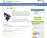
For thousands of years, navigators have looked to the sky for direction. Today, celestial navigation has simply switched from using natural objects to human-created satellites. A constellation of satellites, called the Global Positioning System, and hand-held receivers allow for very accurate navigation. In this lesson, students investigate the fundamental concepts of GPS technology trilateration and using the speed of light to calculate distances.
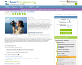
In this lesson, students will learn that math is important in navigation and engineering. Ancient land and sea navigators started with the most basic of navigation equations (Speed x Time = Distance). Today, navigational satellites use equations that take into account the relative effects of space and time. However, even these high-tech wonders cannot be built without pure and simple math concepts basic geometry and trigonometry that have been used for thousands of years. In this lesson, these basic concepts are discussed and illustrated in the associated activities.
Navigation and Transitions in Online Units

This activity guides students through the process needfinding to identify areas of need for their creation of a technology for the "public good." Students will conduct contextual inquiry to identify the needs of their target audience.
Comments
Although this activity can be used in isolation, it is intended to be part of a series guiding students towards the creation of a front-end of a website. The series (all published as OER) consist of:
a) Needfinding
b) Personas, Scenarios and Storyboards
c) Front-end Website Design and Development
d) Accessibility Evaluation
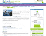
Students examine how the orientation of a photovoltaic (PV) panel relative to the sun affects the efficiency of the panel. Using sunshine (or a lamp) and a small PV panel connected to a digital multimeter, students vary the angle of the solar panel, record the resulting current output on a worksheet, and plot their experimental results.

Normally we find things using landmark navigation. When you move to a new place, it may take you awhile to explore the new streets and buildings, but eventually you recognize enough landmarks and remember where they are in relation to each other. However, another accurate method for locating places and things is using grids and coordinates. In this activity, students will come up with their own system of a grid and coordinates for their classroom and understand why it is important to have one common method of map-making.

The Virtual Learning Community (VLC) is a collaborative effort of the North Carolina Community College System for developing online course content and providing support services for the benefit and success of distance learning students, educators, and eLearning administrators.
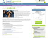
Celestial navigation is the art and science of finding one's geographic position by means of astronomical observations, particularly by measuring altitudes of celestial objects sun, moon, planets or stars. This activity starts with a basic, but very important and useful, celestial measurement: measuring the altitude of Polaris (the North Star) or measuring the latitude.

Students create and use their own simple compasses, which are each made from a bowl of water, strong magnet, stick pin and Styrofoam peanuts. They learn how compasses work and about cardinal directions. They come to understand that the Earth's magnetic field has both horizontal and vertical components.
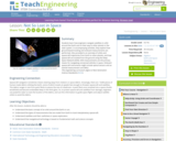
Students learn how engineers navigate satellites in orbit around the Earth and on their way to other planets in the solar system. In accompanying activities, they explore how ground-based tracking and onboard measurements are performed. Also provided is an overview of orbits and spacecraft trajectories from Earth to other planets, and how spacecraft are tracked from the ground using the Deep Space Network (DSN). DSN measurements are the primary means for navigating unmanned vehicles in space. Onboard spacecraft instruments might include optical sensors and an inertial measurement unit (IMU).
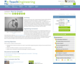
Students expand upon their understanding of simple machines with an introduction to compound machines. A compound machine a combination of two or more simple machines can affect work more than its individual components. Engineers who design compound machines aim to benefit society by lessening the amount of work that people exert for even common household tasks. This lesson encourages students to critically think about machine inventions and their role in our lives.
OER Fundamentals are invited to remix this course planning template to design and share their OER project plans, course information and syllabus, and reflection.
OER Fundamentals are invited to remix this course planning template to design and share their OER project plans, course information and syllabus, and reflection.

OER Fundamentals are invited to remix this course planning template to design and share their OER project plans, course information and syllabus, and reflection.
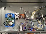
This collection of curriculum materials is tied to five Wake Tech Building Automation Technology courses: BAT 111, BAT 212, BAT 221, BAT 231, BAT 251.
OLPs and Adaptive Learning
Part 2 of offshore hydromechanics (OE4630) involves the linear theory of calculating 1st order motions of floating structures in waves and all relevant subjects such as the concept of RAOs, response spectra and downtime/workability analysis.