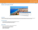
The resource "Western and Southern Europe" is a module in the "World …
The resource "Western and Southern Europe" is a module in the "World Geography" course. The course is included in the Georgia Virtual Learning resource series available in the open educational resources collection of the NCLOR. This resource is included in the Physical Sciences discipline with the subject of Geography.
A good detective or researcher like Sherlock Holmes knows the fundamental questions …
A good detective or researcher like Sherlock Holmes knows the fundamental questions that need to be answered to gather facts to solve a problem. So how does geospatial intelligence contribute to answering these questions? While geospatial technology is useful in revealing who, what, when, and where events take place, it is less useful in explaining why events occur. However, geospatial intelligence analysis leverages geographic information science and technology with the intelligence tradecraft to develop products that support decision-making in national and homeland security, law enforcement, emergency management, and international relief efforts. GEOG 882 will challenge you to think critically, consider alternative viewpoints, and question your own assumptions when analyzing why human events occur over place and time.
In this data rich world, we need to understand how things are …
In this data rich world, we need to understand how things are organized on the Earth's surface. Those things are represented by spatial data and necessarily depend upon what surrounds them. Spatial statistics provide insights into explaining processes that create patterns in spatial data. In geographical information analysis, spatial statistics such as point pattern analysis, spatial autocorrelation, and spatial interpolation will analyze the spatial patterns, spatial processes, and spatial association that characterize spatial data. Understanding spatial analysis will help you realize what makes spatial data special and why spatial analysis reveals a truth about spatial data.
What factors lead to a natural disaster? What causes a famine? Why …
What factors lead to a natural disaster? What causes a famine? Why do cities flood? According to a recent article in The Atlantic, Houston's flooding during the 2017 Hurricane Harvey was primarily caused by impervious pavement which prevents the absorption of water into the land. This example illustrates how nature and society are interlinked, which is the main focus of Geography 30, Penn State's introductory course to nature-society geography. In addition to examining the linkages between human development and natural hazards, this course will also explore human society's connection to food systems, climate change, urbanization and biodiversity. The course will also cover topics of ethics and decision making in order to help students evaluate the tradeoffs of these interconnections. \The Atlantic\" needs to be made into a link pointing to this: https://www.theatlantic.com/technology/archive/2017/08/why-cities-flood/538251/"
Geography 431 is designed to further understanding of the natural processes of …
Geography 431 is designed to further understanding of the natural processes of aquatic ecosystems, management of water resources, and threats to sustaining water quantity. Develop awareness and appreciation of the perspectives about water as a precious resource, commodity, and sometimes hazard. Learn how and why water is distributed unevenly around the Earth. Examine how resource management decisions are strongly related to water availability, quantity, and quality. The course examines water resources management; dams and dam removal; provision of safe potable water; threats to water quantity and quality; land use changes; the water economy; water laws and policy; institutions for water management at the global, national, regional, and local scale; and issues of water security and climate change.
Geo-information has proven to be extremely helpful in many aspects of risk …
Geo-information has proven to be extremely helpful in many aspects of risk and disaster management: locational and situational awareness, monitoring of hazards, damage detection, sharing of information, defining vulnerability areas, etc. This course aims to provide knowledge on risk and disaster management activities, demonstrate use of geo-information technologies in emergency response, outline current challenges and motivate young geo-specialist to seek for advanced solutions. The course is organised as lectures and practicals. The practicals will be in the form of group assignments. Some excursions and guest lectures will be organised as well.
Geographic Intelligence (GEOINT) is more than people working with computers in a …
Geographic Intelligence (GEOINT) is more than people working with computers in a secure intelligence facility. Join us for this exciting journey to learn about GEOINT's application in business, law enforcement, and defense. Advances in satellites, GPS, unmanned aerial systems, wireless communications, handheld computing, and the ability to automate laborious map analysis processes has transformed what used to be called geographic intelligence, or GEOINT, and the nature of the insights provided to managers and leaders. We have gone from mountains of hardcopy maps to amazing automated systems that provide previously unavailable understanding. GEOINT combines geographic information science and technologies with an analytic tradecraft. You will experience the value of GEOINT. We welcome you to the Revolution.
In GEOG 871, we'll take a critical look at geospatial project management. …
In GEOG 871, we'll take a critical look at geospatial project management. Project management is a broad discipline that encompasses technical methods such as system design and analysis and also interpersonal factors that affect professional relationships. Project management is also a discipline that has matured outside of, but can be incorporated into, geospatial technology. By the end of this course, you'll have devised a project plan from a scenario built upon a real-life project involving the city of Metropolis geodatabase. We'll work through each of the components in an organized and logical manner and will incorporate constructive peer review to help everyone achieve the best product possible.
Il y a des femmes qui ont marqué et marquent encore la …
Il y a des femmes qui ont marqué et marquent encore la vie sociale, politique et culturelle d’Haïti : des femmes scientifiques, journalistes, militantes féministes, défenseures des droits humains, politiciennes, écrivaines…
The idea behind the creation of this open textbook is twofold. First, …
The idea behind the creation of this open textbook is twofold. First, it is written as a resource for educators to teach students about the Indigenous historical significance of the lands encompassing the Robinson-Huron Treaty area and more specifically the Greater Sudbury and Manitoulin area. Secondly, through the use of interactive mapping strategies, the textbook will serve as a guide for educators to develop a similar resource to document Indigenous stories from their own areas.
Geography 430 is an active, creative learning community focused around understanding the …
Geography 430 is an active, creative learning community focused around understanding the changing relationships between people and their environments, the causes and consequences of environmental degradation, strategies for building a more sustainable world, and the methods and approaches that scholars have used to understand human-environment interactions. The primary course objectives are to help geographers, earth scientists, and other professionals to deepen their appreciation for the complexity of human-environment systems and to develop skills that allow them to interpret, analyze, and communicate effectively regarding human-environment interactions in their lives as students, professionals, and citizens.
This course provides an understanding of how geospatial perspectives and technologies support …
This course provides an understanding of how geospatial perspectives and technologies support all stages of emergency management activities, from small scale emergency management efforts to large scale disaster/humanitarian efforts. This includes learning about commonly used and emerging geospatial tools. It also includes an exploration of advancements in data collection, processing and analysis capabilities, such as unmanned aerial systems, geospatial artificial intelligence, volunteered geographic information, social media, and many more.
This OPEN textbook was developed as a supplement to Geography 222.3 (GEOG …
This OPEN textbook was developed as a supplement to Geography 222.3 (GEOG 222), Introduction to Geomatics at the University of Saskatchewan. GEOG 222 is a required course for all Geography majors (B.A., B.Sc., B.A.Sc., and Planning), as well as the gateway geomatics course for a Specialization and Certificate in Geomatics. The content of this reader is a mix of original content (95% to 100% of the text and most of the images) created by Professor Scott Bell while other material comes from attributed sources (attribution is included at the beginning of a chapter or section, or for the note taking guide, on each slide or at the culmination of a series of slides).
Knowing Home attempts to capture the creative vision of Indigenous scientific knowledge …
Knowing Home attempts to capture the creative vision of Indigenous scientific knowledge and technology that is derived from an ecology of a home place. The traditional wisdom component of Indigenous Science—the values and ways of decision-making—assists humans in their relationship with each other, the land and water, and all of creation. Indigenous perspectives have the potential to give insight and guidance to the kind of environmental ethics and deep understanding that we must gain as we attempt to solve the increasingly complex problems of the 21st century.
The Nature of Geographic Information is an orientation to the properties of …
The Nature of Geographic Information is an orientation to the properties of geographic data and the practice of distance learning. The purpose of this course is to promote understanding of the Geographic Information Science and Technology (GIS&T) enterprise. GIS&T is the intersection of professions, institutions, and technologies that produce geographic data and render information from it. It is a rapidly growing and evolving field. Learning is a way of life for all GIS&T professionals. With this in mind, I hope that this text may contribute to your lifelong exploration of how geospatial technologies can be used to improve the quality of life-yours and your neighbors', locally and globally, now and in the future.
This book is about how to read, use, and create maps. Our …
This book is about how to read, use, and create maps. Our exploration of maps will be informed by a contextual understanding of how maps reflect the relationship between society and technology, and how mapping is an essential form of scientific and artistic inquiry. We will also explore how mapping is used to address a variety of societal issues, such as land use planning and political gerrymandering. You will gain insight into the technical underpinnings of mapping as a science approach, complement on-going interest and activities, or provide an applied focus for research or policy.
User-friendly Geographic Information Systems (GIS) is the common thread of this collection …
User-friendly Geographic Information Systems (GIS) is the common thread of this collection of presentations, and activities with full lesson plans. The first section of the site contains an overview of cartography, the art of creating maps, and then looks at historical mapping platforms like Hypercities and Donald Rumsey Historical Mapping Project. In the next section Google Earth Desktop Pro is introduced, with lessons and activities on the basics of GE such as pins, paths, and kml files, as well as a more complex activity on "georeferencing" an historic map over Google Earth imagery. The final section deals with ARCGIS Online and StoryMaps with tutorials, basic exercises on pins, paths, and CSV import, and a lesson plan for creating a research project presentation on an historic building in StoryMaps. In addition to an xml file that has been uploaded here to Academic Works, the module is also a live website at https://libguides.brooklyn.cuny.edu/cs-x. The site was created with Libguides software, and is a Community Libguide that can be reused and imported into other LibGuides sites. The website also contains links to two live StoryMaps, one on an Introduction to ARCGIS StoryMaps (https://arcg.is/1SX1zH), and the second, a model assignment on the history of the Fairway building in Red Hook, Brooklyn (https://arcg.is/1nbHP).
Whether you realize it or not, when you carry a smart phone, …
Whether you realize it or not, when you carry a smart phone, use a navigation system in your car, or look up the nearest coffee shop on your computer, you are using geographic information. Geographic data and technologies are embedded in almost all aspects of our lives. GEOG 160, Mapping Our Changing World, explores what geographic information and data are, what makes them unique, how they are created, and how we use them. You'll explore how geographic technologies like geographic information systems (GIS), remote sensing from satellites, and global positioning systems (GPS) work together to provide us with information we rely on. You'll also become an informed consumer of the geographic content in your life.
The past decade has seen an explosion of new mechanisms for understanding …
The past decade has seen an explosion of new mechanisms for understanding and using location information in widely-accessible technologies. This Geospatial Revolution has resulted in the development of consumer GPS tools, interactive web maps, and location-aware mobile devices. This course brings together core concepts in cartography, geographic information systems, and spatial thinking with real-world examples to provide the fundamentals necessary to engage with Geographic Information Science. We explore what makes spatial information special, how spatial data is created, how spatial analysis is conducted, and how to design maps so that they're effective at telling the stories we wish to share. To gain experience using this knowledge, we work with the latest mapping and analysis software to explore geographic problems.
No restrictions on your remixing, redistributing, or making derivative works. Give credit to the author, as required.
Your remixing, redistributing, or making derivatives works comes with some restrictions, including how it is shared.
Your redistributing comes with some restrictions. Do not remix or make derivative works.
Most restrictive license type. Prohibits most uses, sharing, and any changes.
Copyrighted materials, available under Fair Use and the TEACH Act for US-based educators, or other custom arrangements. Go to the resource provider to see their individual restrictions.